- Home
- Accommodation
- Activities
- Area Info
- Maps
- Photo Galleries
- Real Estate
- Travel
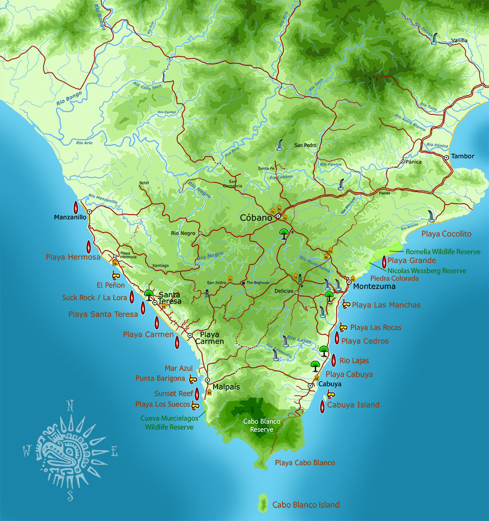
Southern Nicoya Peninsula Map
More Detailed Maps
The following are highly detailed, official maps presented online by UNA – University Nacional de Costa Rica. These four maps cover the entire southern Nicoya Peninsula in great detail:
Rio Ario – Northwestern part of the peninsula, from Playa Hermosa north, including Manzanillo. Also, Cobano north, and almost all of Tambor.
Cabuya – Southern part of the peninsula, including Santa Teresa, Malpais, Montezuma, Cabuya, Cabo Blanco Park, and most of Delicias.
Tambor – Part of Tambor Bay, Paquera, Curu, Tortuga Island
Golfo – North of Paquera, Naranjo, Island of the Golfo de Nicoya
Great Stuff

Clandestina Restaurant
My new favorite restaurant, Clandestina is not to be missed by food lovers staying anywhere near to Montezuma. Established in March 2015, Clandestina is the new kid on the block. The Oregon/Tico collaboration is a winner among locals and travelers alike, with artisan craft beers, made onsite by Butterfly Brewing Co. and delicious, exciting […]


