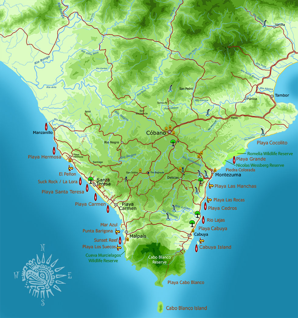
The following are highly detailed, official maps presented online by UNA – University Nacional de Costa Rica. These four maps cover the entire southern Nicoya Peninsula in great detail:
Rio Ario – Northwestern part of the peninsula, from Playa Hermosa north, including Manzanillo. Also, Cobano north, and almost all of Tambor.
Cabuya – Southern part of the peninsula, including Santa Teresa, Malpais, Montezuma, Cabuya, Cabo Blanco Park, and most of Delicias.
Tambor – Part of Tambor Bay, Paquera, Curu, Tortuga Island
Golfo – North of Paquera, Naranjo, Island of the Golfo de Nicoya